- Entry
- 015
- Source scale
- 1:24,000
- Method
- Field measurement and compilation
- Section
- Hydrography
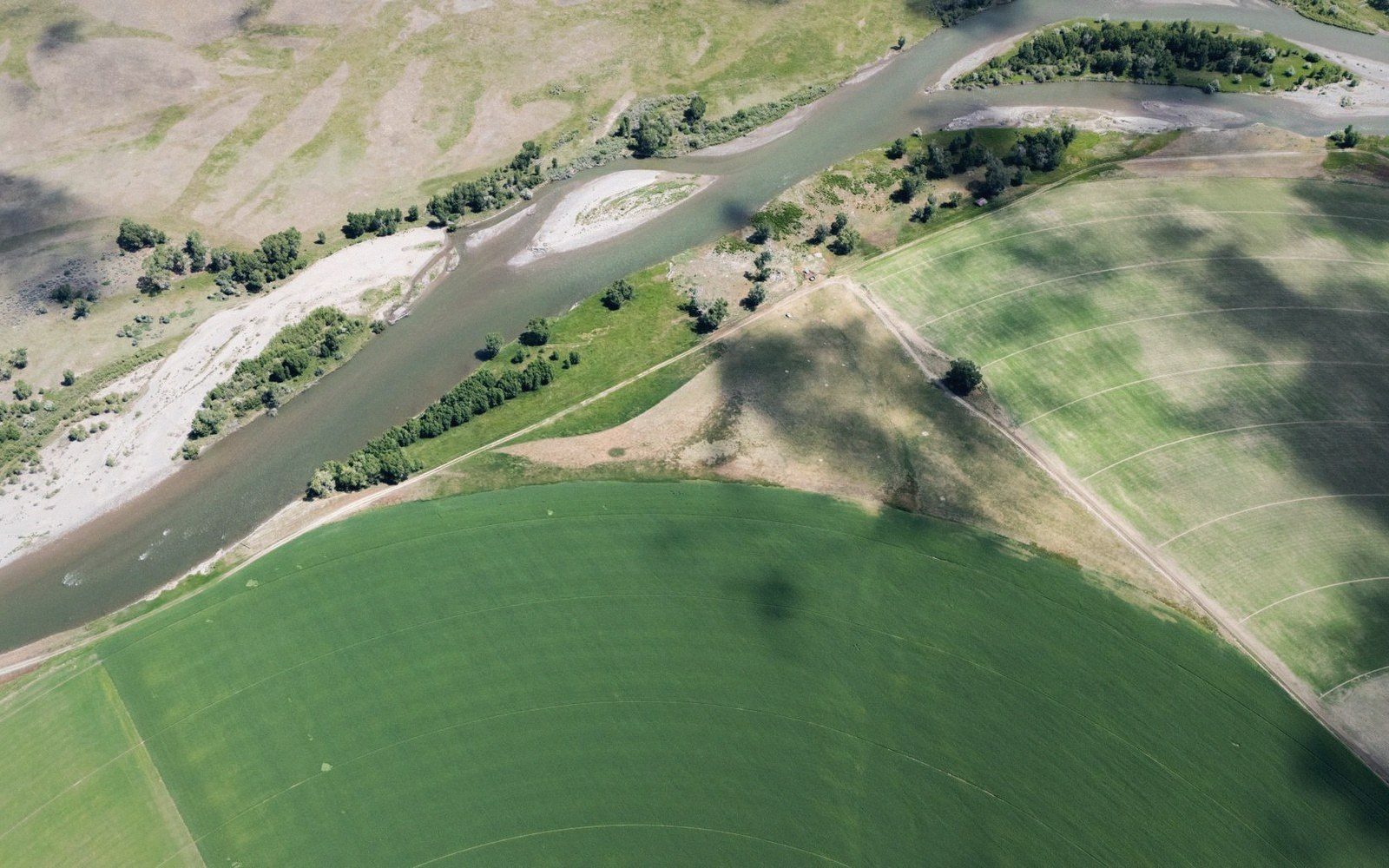
An abandoned bend stays legible in the crop for decades, which is how a sheet can be checked against a course it no longer shows.
Photo: Sam McCool / PexelsWhen the river left, the mark remained
An oxbow cut off cleanly — a meander neck narrows over decades, the river breaks through in flood, and the new straight course becomes the main channel overnight. The old loop is abandoned. Within months it silts at both ends and becomes a standing-water body: classic billabong, oxbow lake, mort-eau in French-speaking survey traditions. Within years, it dries to a depression. Within a generation, the crop tells you everything the sheet no longer shows.
The reason is differential moisture. The abandoned channel filled with fine alluvium — clay and organic matter, carried in during every subsequent flood — and that fill holds water longer than the surrounding field. Walk the land in a dry June and the old bend is written in the standing wheat: a darker strip of green tracing an arc through a pale, drought-stressed block. From the ground you might not even see the slight topographic hollow. From an aircraft, or from a satellite at harvest, the curve is unmistakeable. The shape is eloquent precisely because rivers do not turn at right angles.

A compiled sheet describes ground the compiler is not standing on.
The survey record rarely keeps pace. The original sheet may show the meander in blue. A revision, perhaps decades later, may drop the blue line and show the land as undifferentiated arable. A modern airborne laser survey will resolve the residual hollow as bare-earth topography — a depression of perhaps half a metre below the surrounding surface — even under winter wheat. But the agricultural record, the cadastre, the drainage board's maps: these may each preserve a different moment in the same channel's life, which is why two official sheets over the same ground can show features that flatly contradict one another.
The practical consequence for anyone working with historical boundaries is significant. A boundary described as following the river's thalweg — the line of greatest depth — becomes ambiguous the moment the river jumps. The old channel, the new channel, and the surveyed centre-line on the sheet are three different lines. Which one the boundary follows depends on the wording of the original instrument, and surveyors have argued that point in court more than once.

Every sheet crosses a table like this one before it is printed, and picks up a decision at each pass.
The crop marks are not an anomaly. They are the most durable record of what actually happened.
- Oxbow lakestanding water in the sealed-off loop; first stage after cut-off
- Mort-eauFrench survey term for a dead arm of a river; still-water remnant
- Thalwegthe line of greatest depth, used as a legal centre-line in boundary descriptions
- Differential moisturethe mechanism by which crop marks trace the old channel in dry conditions